Afghanistan#
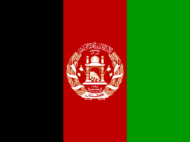
Ahmad Shah DURRANI unified the Pashtun tribes and founded Afghanistan in 1747.
Government type: theocratic; no UN member state has formally recognised the Taliban Government. Chief of state: Taliban Leader HAYBATULLAH Akhundzada (since 15 August 2021).
Facts#
Capital |
Kabul |
Region |
Southern Asia, north and west of Pakistan, east of Iran |
Area |
total : 652,230 sq km; land: 652,230 sq km; water: 0 sq km |
Population |
49,474,805 (2025 est.) |
Languages |
Afghan Persian or Dari (official, lingua franca) 77%, Pashto (official) 48%, Uzbeki 11%, English 6%, Turkmani 3%, Urdu 3%, Pashaie 1%, Nuristani 1%, Arabic 1%, Balochi 1%, other <1% (2020 est.) |
Currency |
afghanis (AFA) |
Time zone |
to be filled |
ccTLD |
.af |
Provinces#
Afghanistan is divided into 34 welayat (provinces), each run by a provincial governor and a capital city that anchors the security, trade, and tribal hubs of the region.
Province |
Capital |
Region |
|---|---|---|
Badakhshan |
Fayzabad |
northeast |
Badghis |
Qala-e-Naw |
northwest |
Baghlan |
Pul-e-Khumri |
north |
Balkh |
Mazar-i-Sharif |
north |
Bamyan |
Bamyan |
central highlands |
Daykundi |
Nili |
central highlands |
Farah |
Farah |
west |
Faryab |
Maymana |
northwest |
Ghazni |
Ghazni |
southeast |
Ghor |
Chaghcharan (Firozkoh) |
central highlands |
Helmand |
Lashkar Gah |
south |
Herat |
Herat |
west |
Jowzjan |
Sheberghan |
north |
Kabul |
Kabul |
east-central |
Kandahar |
Kandahar |
south |
Kapisa |
Mahmud-i-Raqi |
east-central |
Khost |
Khost |
southeast |
Kunar |
Asadabad |
east |
Kunduz |
Kunduz |
north |
Laghman |
Mihtarlam |
east |
Logar |
Pul-i-Alam |
east-central |
Nangarhar |
Jalalabad |
east |
Nimroz |
Zaranj |
southwest |
Nuristan |
Parun |
east |
Paktika |
Sharana |
southeast |
Paktiya |
Gardez |
southeast |
Panjshir |
Bazarak |
northeast |
Parwan |
Charikar |
east-central |
Samangan |
Aybak |
north |
Sar-e Pul |
Sar-e Pul |
north |
Takhar |
Taloqan |
northeast |
Uruzgan |
Tarinkot |
south-central |
Wardak |
Maidan Shahr |
east-central |
Zabul |
Qalat |
south |
Ethnicities#
Afghanistan has no recent official census; published ethnic shares are contested estimates rather than ground truth. The Pashtun plurality dominates the south and east, Tajik and Uzbek populations hold the north, and the Hazara concentrate in the central highlands.
Group |
Share (est.) |
Core area |
Primary language |
|---|---|---|---|
Pashtun |
~42% |
south, southeast, east |
Pashto |
Tajik |
~27% |
northeast, west, Kabul |
Dari |
Hazara |
~9% |
central highlands (Hazarajat) |
Dari (Hazaragi) |
Uzbek |
~9% |
north |
Uzbeki |
Aimaq |
~4% |
west, Ghor |
Dari (Aimaqi) |
Turkmen |
~3% |
north along Turkmenistan border |
Turkmani |
Baloch |
~2% |
southwest (Nimroz, Helmand) |
Balochi |
Nuristani |
<1% |
Nuristan, Kunar |
Nuristani |
Pashai |
<1% |
Laghman, Kapisa, Kunar |
Pashaie |
Other |
~3% |
mixed |
mixed |
Dialects#
Dari and Pashto are the two official languages; the rest serve ethnic homelands listed above. Operators should expect heavy code-switching between Dari and Pashto in urban areas, while rural districts hew to a single tongue and dialect.
Language |
Family |
Major dialects |
Where spoken |
|---|---|---|---|
Dari (Afghan Persian) |
Indo-European, Iranian |
Kabuli, Herati, Hazaragi, Aimaqi, Panjshiri |
nationwide lingua franca; Kabul, Herat, north, central highlands |
Pashto |
Indo-European, Iranian |
Northern (Yusufzai, Ghilji), Southern (Kandahari), Central (Wardak, Waziri) |
south, southeast, east; cross-border into Pakistan’s KP |
Uzbeki |
Turkic |
Northern Uzbek (Afghan variant) |
northern provinces (Jowzjan, Faryab, Sar-e Pul, Balkh) |
Turkmani |
Turkic |
Teke, Ersari |
far north along Turkmenistan border |
Balochi |
Indo-European, Iranian |
Rakhshani (Western Balochi) |
southwest (Nimroz, Helmand) |
Pashaie |
Indo-European, Dardic |
Northwest, Northeast, Southwest, Southeast clusters |
Laghman, Kapisa, Kunar, Nuristan foothills |
Nuristani |
Indo-European, Nuristani branch |
Kati, Waigali, Ashkun, Prasun, Tregami |
Nuristan, eastern Kunar |
Arabic |
Afro-Asiatic, Semitic |
liturgical (classical), small Khorasani Arabic enclaves |
religious instruction nationwide; pockets in Balkh, Jowzjan |
Refugees#
Camps hosting refugees, asylum-seekers, and internally displaced persons (IDPs) inside the country. Operators use this to track population movement, NGO and UN footprint, humanitarian access corridors, and the political pressure conflict generates on the host. Cross-reference UNHCR Operational Data Portal, IOM DTM, and ReliefWeb before relying on the entry.
Camp |
Population |
Origin |
Location |
Notes |
|---|---|---|---|---|
to be filled |
to be filled |
to be filled |
to be filled |
to be filled |